Interactive map highlights the potential of geothermal across the entire UK
 Overview of geothermal energy potential for four geothermal technologies in Great Britain: Closed loop GSHP, open loop GSHP, hot sedimentary aquifer and deep geothermal, EGS granites. (Contains OS data © Crown Copyright and database right 2025, data © Department for Energy Security and Net Zero, 2025, data BGS © UKRI 2025.)


The British Geological Survey has published a freely available online platform that summarizes geothermal potential using different technologies across the UK.
The British Geological Survey has launched the UK Geothermal Platform, an online, interactive and freely available platform that provides information on geothermal potential in the UK, both for shallow and deep technology options.
The map explorer is a user-friendly interface for visualising and examining spatial summary and data layers. There are summary layers for:
- shallow, vertical closed loops with ground-source heat pump
- shallow, open loops with ground-source heat pump
- deep, hot, sedimentary aquifers (hydrothermal)
- deep, engineered geothermal systems in granites (petrothermal)
The summary layers provide information on geothermal energy potential, including indications of thermal output, temperature and cost information based on the study “UK geothermal energy review and cost estimations” (Arup, 2025). Such information is valuable for regulators, developers, and researchers looking into developing geothermal systems.
For instance, the platform highlights that closed-loop systems can technically be deployed almost anywhere across Great Britain (local planning and regulatory constraints apply). Up to 55% of the population has the potential to extract up to 15000 kWh of thermal energy (the typical annual energy of a gas boiler), via a single, 150 m-deep, closed-loop system.
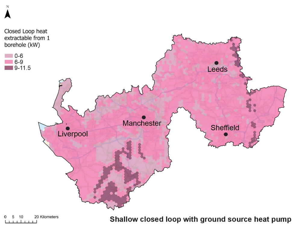
Towns, cities and industrial sites can be assessed for the potential to retrofit geothermal technology and new development zones can be quickly assessed for strategic use of geothermal energy from the start of the development or planning cycle. For example, planned development for the Liverpool–Manchester–Leeds–Sheffield growth corridor can take advantage of multiple geothermal energy technologies.
The openly available platform features a user-friendly map explorer and a data access page that also enables you to view more detailed geoscientific information from several organisations, including BGS, the Mining Remediation Authority, environmental agencies, the North Sea Transition Authority and the UK Onshore Geophysical Library.
The first release of the UK Geothermal Platform has been funded by the UK Government’s Department for Energy Security and Net Zero (DESNZ) through the Net Zero Innovation Portfolio. It is delivered and maintained by BGS.
“For the first time, the UK Geothermal Platform makes a large volume of national-scale geothermal data and information available and digitally accessible,” commented Dr Alison Monaghan, head of geothermal at BGS. “It supports a wide range of users in understanding at high level the potential for a range of geothermal energy options, supporting decarbonisation of heating and energy security.”
Source: British Geological Survey


